The spark of this idea ignited in the city of Edinburgh, Scotland. While shopping for Gene's boots in various adventure stores, we were told of a land rich with outdoor adventures. Naturally we were intrigued by such an idea and with no real deadline to get to London we further researched this initiative. Gene and I had to gather additional gear if we were to survive the summit attempt. Lacking in long underwear and gloves, I set out on a quest to buy those essential items that would allow the realization of such a summit. After checking with several outdoor stores, clothing stores and any stores in general that we thought might have long underwear, we discovered that items we were looking for were well out of season, it is spring here in the highlands of Scotland. The only sizes I could find were XL and XXL. I decided to wait and hope that Fort Williams would have our much needed supplies.
Following Loch Ness and Loch Lochy southeast of Inverness brings along the small town of Fort William. About an hour's hike southwest of Fort William is the smaller town of Glen Nevis. It is there where we set our scene. We booked a hostel that claims to be at the base of the trail leading to Ben Nevis, perfect. In Fort William, Gene and I were finally able to come across affordable gloves and long underwear that were not two sizes too big. With our new found budget gear, we came to a conclusion that we would camp at the lake, a little under half way up to the summit. The next day we would tackle the summit.
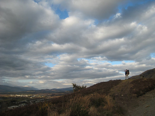
On April 20, 2008 9:30am, we head into town with the minimum of camping supplies and photography gear. At the Morrison's, local grocery store, we buy £18.36 ($36.72) which gets us two day's supply of mackerel, cheese, bread, raisins, and snack bars. From the town of Fort William, 40 meters above sea level, we hike towards Ben Nevis, 1,344 meters above sea level. It is about an hour hike from Fort William to the foot of Ben Nevis, with fresh legs it's cake.
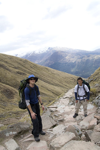
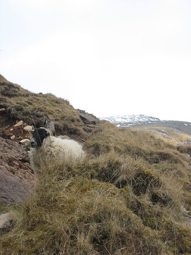
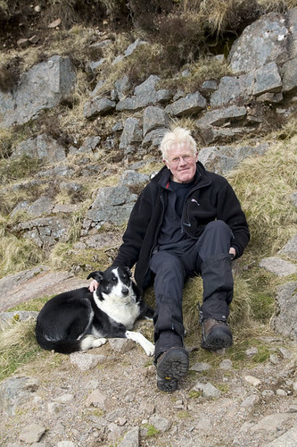
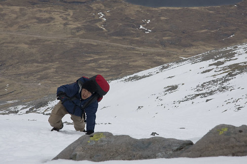
The base of the trail starts near a farm where goats scatter across the landscape. We are greeted with "blaaaahs" as walk by the grazing animals. The ground is rocky but the rocks are similar in size and create a nearly level walking surface. The trail gradually climbs up the side of the mountain via switchbacks, zig zags. The farther up in elevation we climb the rougher the terrain. The trail, outlined by rocks, differ more and more in size as we ascend. Large boulders and smaller rocks slow our ascent. The sound of trickling water appears around every bend and small waterfalls breakup the trail. Selecting our footing carefully we scale side of Ben Nevis and run into several other hikers that are on their way down. Amongst them was a local with his dog. Apparently the townies that hike Ben Nevis all know each other and we easily stood out. Two more trips and it would his dog's 200th climb to the summit. If his dog was about to hit number 200 it was clear that he knew the mountain like the back of his hand. He greeted us and questioned our intent with concern. You don't have a cell phone? No real compass except for your GPS? no crampons? He shared several good tips and even gave us a small maps of the summit. We took pictures and continued up.
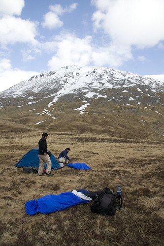
We reach the lake around late afternoon. At roughly 600 meters (2,000 feet) above sea level we setup base camp and retired for the day. Nate and I setup our sleeping bags and bivy sacks while Gene setup his new tent that he got from his hiking shoe purchase. We watched as the last of climbers descended the mountain and tired from our climb we fell asleep pretty quickly.
The temperatures dropped below freezing and I awoke to a sound of a distant goat "blaaaaahh". I quickly unzipped my bivy sack which happened to face west. It was around 8pm, the sun was just setting and entire valley slowly darkened. At the edge of the mountain as the half oval sun made its departure two shadows appeared. As the sunset became less intense I could make out a better outline of the two silhouettes. It looked like a pair of deer, but I am unsure. They moved towards our camp putting the lake between them and us. The skies darkened even more to where I had no interest. I re-zipped my bivy to conserve heat and attempted to go back to sleep.
The winds seem to pick up at night. It almost seemed like someone was shaking my bivy sack. The gusts came and went suddenly and abruptly. There would be long instances of peace and quiet between strong gusts. I fell alseep for a while and then awoke again as a strong wind shook and whipped the fabric of the bivy sack across my face. Again, I un-zipped the bivy and peered out. My eyes had adjusted to the darkness and the sky was crystal clear. The stars had come out, but I noticed they were fading. To the east a strong orange glow was emerging from the side of the mountain. I watched as the light became more and more intense to where it eventually drowned out the sparkle of the stars. It was the moon, a full moon in fact. I was so bright that it seemed like a light bulb in the sky.
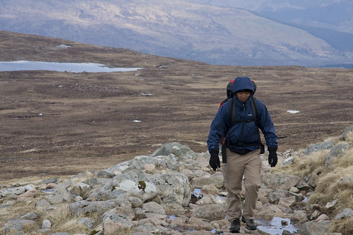
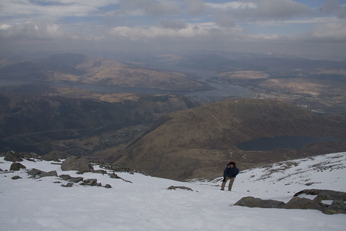
April 21, 2008 we awoke with the sun and packed up camp around 9:30. Carrying only food and storing more of our other equipment in Gene's tent we departed to tackle the larger half of the summit. The paths are even steeper and more uneven. Snow begins to replace the ground we walk on. When we started our journey there were several hikers that had already reached our altitude. They passed us with great velocity with their snow ready shoes. The snow trails are much harder to navigate. The snow itself is hard and additional strength is needed to dig in for proper footing. At this point I am walking on the edges of my boots. In order to achieve proper and safe footing you much angle your step into the mountain, much like how a snowboard or ski cuts into the mountain.
The snow gets harder and harder the further up we ascend. At the snow line where the rock steps stop and the snow trails begin, I start to see people turning around. The hikers who passed us with great haste are now turning around claiming that the snow is too much. The view from here is amazing, our tent at base camp is now a tiny dot while squinting. We continue our trek upwards. At this point the wind starts to pickup. Strong gusts warrant a 45 degree lean into the wind just to maintain safe footing. We dig deep and continue onward taking breaks and shelter amongst the few rocks that inhabit this altitude. The mountain slopes inward and upward at this point to where we can no longer see our base camp.
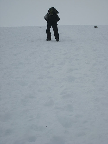
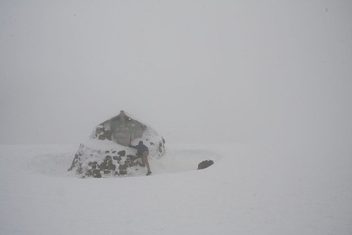
At the top and wind is blowing my hood so loudly that I can barely hear Nate who is about an arm's length away. A whiteout occurs to where the ground and sky blend together in sheet of whiteness. Following the trail of footprints in the snow we finally make it to the summit where after a series of cliffs, sits an emergency shelter. The joy of making it to summit was quickly ends as the weather gets worse and we decide that its better if we depart from the peak. The visibility at this point is about 10feet. Small birds fly around in this weather which absolutely amazed me. They were getting tossed around at the mercy of the winds; Nevertheless they seemed content on staying. After taking several pictures we walk by the cliffs yet again. At this point a group of four ice climbers are just now reaching the summit. With crampon's and an ice axle in each hand, they tell us that the climb was pretty quick at 4hrs 35mins. That duration on a ice seem insane to me.
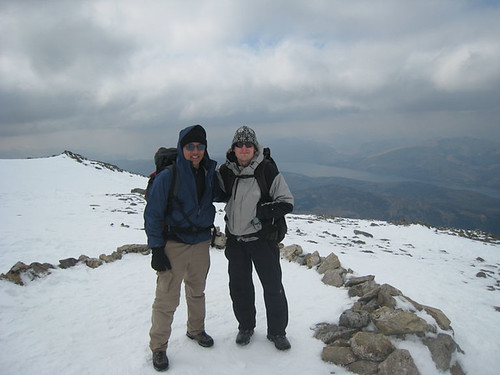
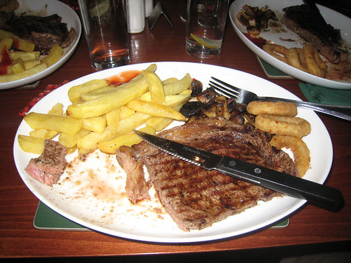
We had conquered the tallest peak in all of the United Kingdom, now the tough part is getting down. The once tough to climb snow is no problem on the descend. We take short cuts from the switchbacks by sliding down on the snow. The weather warms with each step I take and the layers of clothing starts to come off. There are many grooves in snow where people had already slid down. We make it back to the base hostel around 5pm and pack up all of our gear that we left at the hostel. Once again fully loaded with our equipment we trek back to Fort William. That hour walk was killer on the knees, but we managed to make it to town Fort William and find a room around 6pm. After a much deserving shower, we decided to treat ourselves for our conquering of Ben Nevis to a steak dinner around the corner. Tonight I will get the best sleep I've had in a long time.
Nice job conquering the mountain! I really like reading your entries. I think you should conquer a mountain in every continent. Watch out for Everest!
ReplyDeleteExcellent work, good pics and reportage!!
ReplyDeleteNice one. I think the whiteout would be the toughest part, but the climb sounded fun. Keep the stories coming...
ReplyDeletePS - Happy Birthday
ReplyDelete